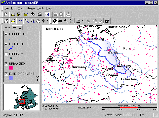
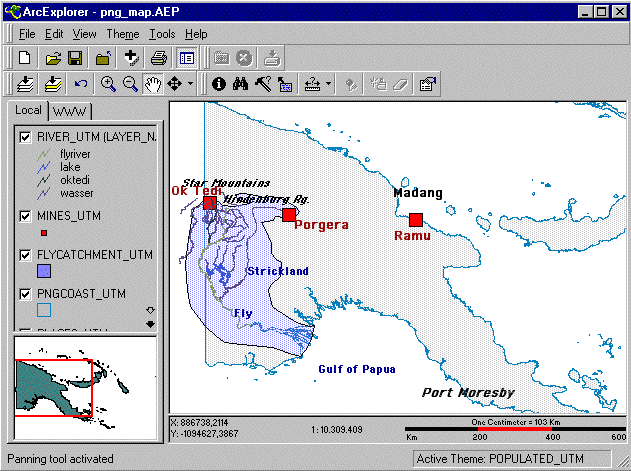
Elbe and Ok TediRiver Elbe and the Ok Tedi/Fly River system are of similar size of watershed (150,000 km2 and 90,000 km2) and length of the main river (1,300 km and 1,100 km). The rest is very different. |
| feature | Elbe | Fly River |
| length (km) | 1,300 | 1,100 |
| catchment size (km2) | 150,000 | 90,000 |
| climate, maximum rainfall (m) | moderate maritime to
continental 1.5 m (Riesengebirge, "Giant Mountains") |
tropical 14 m (Star mountains) |
| discharge to the sea (m3/second) | 900 | 8000 |
| copper load tons/year | 300 | 30,000 |
| prevalent landcover | agriculture | rainforest |
| inhabitants (million) | 25 | 0.1 |
| principal industries and trade | chemical, food processing, machine building, fine mechanical and electronics, energy, financal and insurance, harbour and transport, press, advertisement, administration (Berlin!) | |
| mining | ongoing: lignite (brown
coal) mining, Bohemian Basin
and Middle Elbe plains, open
pit mines, waste material
set aside and used for
landscape rehabilitation;
medieval: copper, silver, lead in the Ore Mountains and Harz; underground pit recent: uranium at Wismut Aue, Ore Mts., underground pit, radioactive waste in slag heaps Potassium salt: Middle Elbe plains, abandoned in 20th century medieval and ongoing: Sodium salt, coastal plain, underground leaching |
Ok Tedi, copper; Porgera, gold |
 Index of Ok
Tedi pages
Index of Ok
Tedi pages back to
Homepage
back to
Homepage
 rettet-die-elbe.de