Ok Tedi Environment
The Star Mountains and the Hindenburg Range, with elevations above
3,000 m, divide the waters of the Sepik to the north, and the Fly River
system to the south. The Fly River and its most important tributaries Strickland
River and Ok Tedi, form a watershed of 100,000 km2. The Fly has a length
of 1,100 km. With rainfalls some of the highest in the world - up to 14
m/year - the relatively short rivers are fed with enormous quantities of
water. After a short course in the mountainous area, through V-shaped valleys
and narrow gorges, the rivers enter the lowlands. From the junction of
Ok Tedi and Fly, the river descends only 20 m to sea level. It is meandering
in wide bows, forming sediment walls on the banks and at the mouths of
smaller tributaries, large swamp areas, and shallow lakes behind the bank
walls. Approaching the sea, it opens to a wide funnel with many islands
in between. Because of the high tidal range, and a sudden drop of riverbed
level to sea ground, a tidal bore develops regularly at the mouth of the
Fly. Precipitation at the estuary still exceeds 2 m/year.
According to landscape, vegetation ranges from highland rainforest,
lowland rainforest, swamp plains, savanna, to mangroves. New Guinea is
famous for its bird- and insect life. As the Fly River catchment is sparsely
inhabited, wildlife is undisturbed on large areas, even compared to Newguinean
standards.
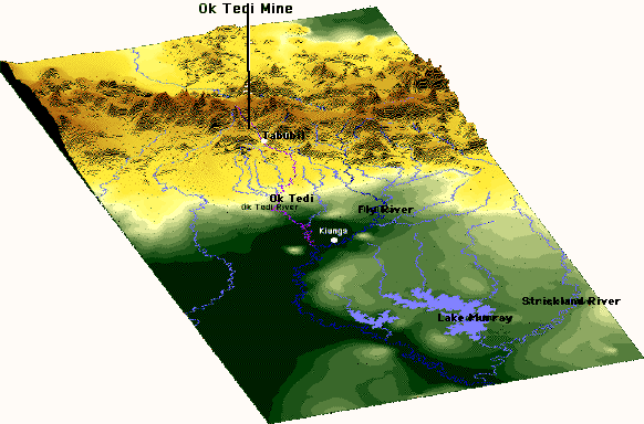
Digital Elevation Model, compiled from data of ATDI - cartography
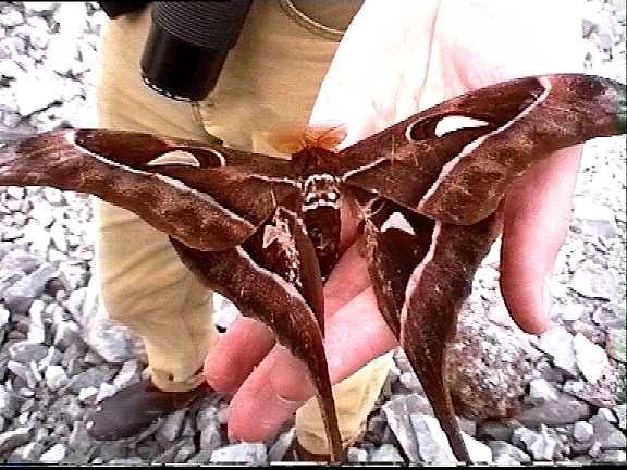
Moths are attracted by the floodlights of the mine, where work is going
on day and night. Moth movie
The Fly River system inhabits the most diversified stock of fresh water
fish in the Australasian region. Hettler quotes an investigation by Roberts
in 1978, that 105 freshwater fish species were found, compared to only
57 in the Sepik. Numerous mollusks, crayfish and shrimp, amphibians, and
reptiles, among them giant salt water crocodiles, live in the Fly.
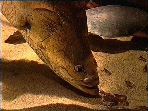
Barry the Barramundi (Lates Calcarifer) is feeding on jabbies at Sydney
Aquarium (Picture from SA video)
The Fly River is a core habitat of Barramundi, which may grow 1.5 m and
60 kg here. Barramundi spawn in the coastal waters, and migrate upstream
to feed and grow. Besides black bass and freshwater prawn, it is the preferred
target of commercial fisheries. Barramundi is grown in aquaculture at many
sites around the Chinese Sea, but wild barramundi is priced higher.
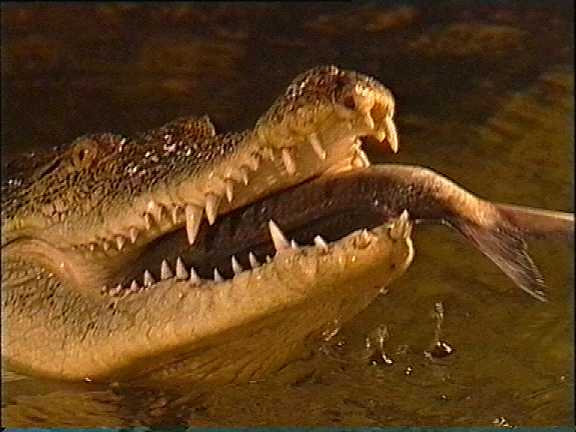
Crocodiles and men complete the food chain. Whether man eats crocodile,
or crocodile eats man, is a matter of circumstance. This "Saltie" lives
at Sidney Aquarium. (Picture from SA video)
Due to variable hydrologic conditions - river level at Kiunga may change
15 m within a day - most species are opportunistic and adapted to natural
desasters. The impact of the mine, however, adds a new threat to life in
the river.
Original issue April 2001
last update
 Environment - Impacts
Index of Ok Tedi pages
 backto Homepage
|

 rettet-die-elbe.de